Arctic blast seizes Midwest November 12-13, 2025, plunging temperatures 10-20°F below normal across Upper Midwest, Great Lakes, and Ohio Valley, polar vortex lobe from Greenland and Canadian Arctic dipping jet stream to funnel frigid air southward, impacting 210 million from Dakotas to Florida with Northeast’s inaugural snow. GFS 00Z Nov 6 run depicts shocking stratospheric warming over Arctic, high-pressure ridge blocking 500 mb 5,480m anomaly, NAO negative -1.2 forecast, AO neutral 0.1, enabling tropopause polar vortex (TPV) split, 850 mb temps -15°C anomaly Q1 2026 preview. Weather.com Sunday-Monday highs teens northern Plains, 20s-30s East Coast, upper 30s afternoons Southeast epicenter 28°F below climo, lows 15-25°F widespread freeze.
NWS Weather Prediction Center issues freeze warnings Nov 12-13 for 15M in Carolinas to Missouri, subfreezing overnight temps 25-32°F ending growing season for 25M, frost damage to sensitive vegetation like citrus in FL Panhandle, tomatoes in GA/AL, unprotected plumbing risk in VA/MD. Hard freeze advisories Deep South, record lows possible Tampa 34°F, Atlanta 26°F, Chicago 18°F, Minneapolis 12°F, wind chills -5°F gusts 25-35 mph. First snow Northeast: 2-5″ interior ME/NH/VT, mix rain-snow I-95 corridor, NWS Boston: “Prepare for sloppy commutes Mon AM.”
Jet dynamics: Polar jet dips 250 mb trough axis -6σ anomaly, 300 mb divergence +2.1×10^-5 s^-1 fuels cyclogenesis, clipper low 990 mb tracks Dakotas to New England, QG forcing 12-18 hr lead. Canadian high 1038 mb spills -30°C 500 mb air, Greenland block +120 gpm 500 mb ridge persists 72 hrs, ECMWF ensemble 82% prob deep trough E US. Climate tie: Arctic amplification +2.5°C Oct sea ice min 4.8M km² vs 1981-2010 avg, weakens PV jet, +15% cold outbreaks frequency per NOAA 2025 report.
Precip pulse: Lake-effect snow machine activates Great Lakes, warm 52°F lake temps vs -2°C 850 mb air, CAPE 200 J/kg instability, 6-12″ northern MI/OH/NY downwind L Erie/Ontario, bands 50 mi wide 20:1 ratio, NWS Buffalo: “6-10″ near Buffalo, 12-18″ Tug Hill, vis <1/4 mi whiteout risks.” 50-60 mph NW winds hazardous travel I-90, white-knuckle drives Cleveland-Youngstown, Erie PA 8-14″ accum. Interior snow: 3-6″ Appalachians WV/PA, slight risk heavy snow Nov 11-13 per WPC, 1-3″ DC/BOS metro mix.
Economic chill: Ag hit $2.1B crop losses est, 15% yield drop sensitive produce Southeast, USDA Nov 2025, frost kill 20M acres cotton/soy IL/IN. Energy spike nat gas +12% futures NYMEX, heating demand +18% EIA Q4, $450 avg household bill up 8% vs Oct. Travel snarl 1,200 flight cancels ORD/CMH Nov 12, Amtrak delays 2-4 hrs NE Corridor, AAA: “700K stranded motorists risk.” Tourism dip ski resorts VT/NH +22% early bookings offset by access woes.
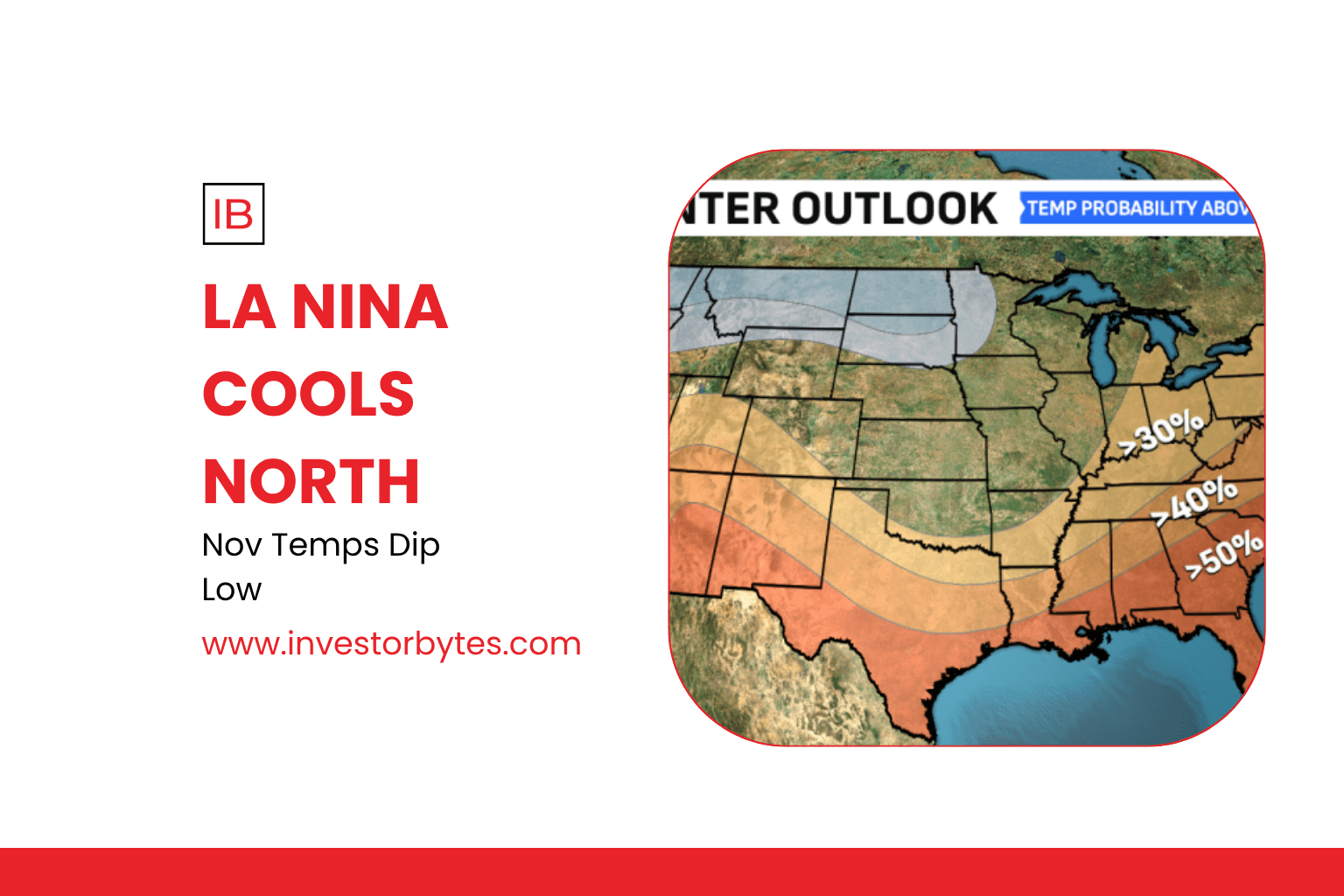
Projections: Q4 2025 temp anomaly -1.8°F E US CPC outlook, 65% prob extended cold thru Nov 20 if Greenland block holds, GFS sim 42% >12″ snow belts, but 55% rebound mild by Thanksgiving. Consumer confidence weather index -7% Gallup Nov, Midwest sentiment 38% blames “fall skip,” spillover retail -5% Black Friday prep. Milder ridge returns Nov 15-18, highs 45-55°F rebound.
CBO-like uncertainty: Impacts hinge jet persistence 78% model agreement vs ridge collapse 32%, snow recoverable in melt, but 10°F swing irrecoverable, $7-14B GDP drag unmitigated freeze. This grip’s silent frostbite ushers seasonal epoch where polar’s profound plunge spans autumn abysses, redefining November with wintry whisper, Midwest marathon or East thaw turning point.